
Edgewater ZIP Directory Coverage
USPS mailing standards group two standard delivery codes under Edgewater. The sources support a broad north and south pattern, but they do not publish a simple street line that should be used as a legal border. The Edgewater ZIP code directory therefore treats each full address as the unit to verify. City Hall, the library, and the retail post office provide official examples for the northern code. Public addresses along the southern US 1 corridor and in Florida Shores support the other code.
| ZIP | Edgewater pattern | Postal facility | Important note |
|---|---|---|---|
| 32132 | Northern and older central Edgewater examples, including city offices and the library | Edgewater Post Office, 400 S Ridgewood Ave. | City government uses 32132; a city limit is not a postal boundary |
| 32141 | Southern Edgewater, US 1, and Florida Shores examples | Served within the Edgewater postal grouping | No separate 32141 retail facility was verified; check each address with USPS |
Both are standard delivery codes. The research found no separate Edgewater PO-box-only or unique institutional code and no authoritative split year. Those details should not be invented from a commercial map. USPS's one-address tool is the sound source for a current delivery label.
Edgewater ZIP Code Postal Anchor
The official Edgewater Post Office listing identifies the retail site at 400 S Ridgewood Avenue, Edgewater, FL 32132-9998. It lists 386-428-6656 and 800-275-8777, with retail hours Monday through Friday from 9 a.m. to 5 p.m. and Saturday from 9 a.m. to noon. Sunday is closed. Facility hours can change, so use the live page before a visit.
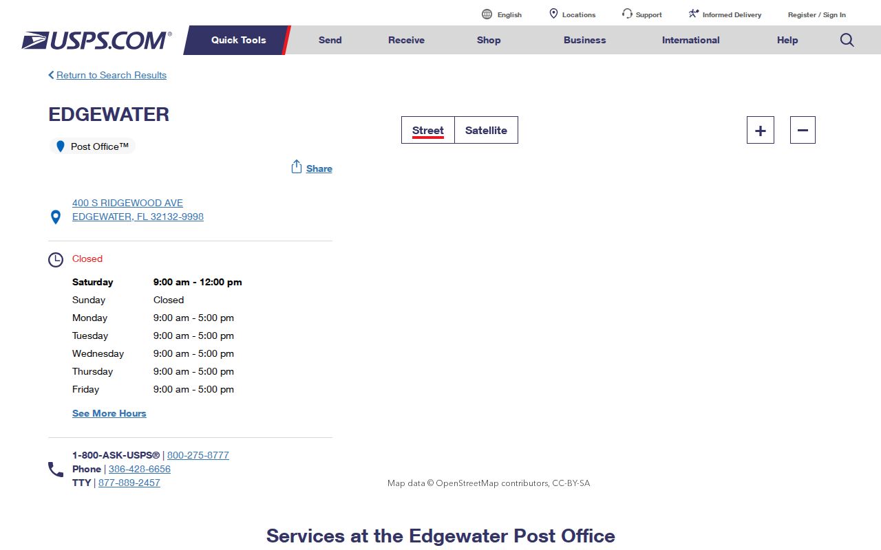
The 32132-9998 form is the post office facility's full ZIP+4. It should not be copied onto a different address without a USPS result for that address.
This one verified retail office also explains why the postal facility column differs from the service-area column. USPS groups 32141 under Edgewater even though the inspected source did not identify a second retail location for it.
Verify an Edgewater ZIP Code
Use the USPS ZIP Code Lookup for one complete location. It standardizes the mailing address and returns the delivery code rather than asking the reader to judge a generalized map. Enter the physical street details as written on the source record. Apartment, suite, or other unit data can change the returned ZIP+4.
| USPS form field | How to enter it |
|---|---|
| Street Address | House number and street name |
| Apt/Suite/Other | Unit detail when the address has one |
| City | Edgewater or the postal city shown by the source |
| State | Florida |
| ZIP Code | Optional known code used for confirmation |
The official form and its address mode are shown below.
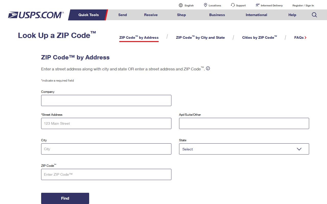
The returned standardized line is the best postal check for one address. It still says nothing by itself about parcel ownership, present occupants, or municipal jurisdiction.
Search Edgewater Records by ZIP
The Volusia County Property Appraiser Classic Search has a real ZIP filter. It can group parcel-roll rows for 32132 or 32141, then add Edgewater, a street, or other land fields to narrow the result. The grid returns Alternate Key, Short Parcel, Owner Name, Site Address, City, and property class. This is a property list, not a list of everyone who lives in the ZIP.
- Confirm a sample address in USPS so the working code is current and standardized.
- Open Property Appraiser Classic Search and enter 32132 or 32141. Add City Edgewater or a partial street only when the first result is too broad.
- Compare each site address and City field with the parcel detail. Keep the owner's mailing address separate from the physical site.
- Check the parcel against city corporate limits when jurisdiction matters. If the goal narrows to a whole road, continue with the Edgewater street directory.
A voter file may also support a lawful geographic request, but the public self-service voter lookup is identity-gated and is not a ZIP browser. Volusia Elections accepts online, email, phone, mail, and in-person record requests. Protected addresses and statutory fields are removed or redacted.
The Property Appraiser also offers street number, direction, street name, suffix, unit, subdivision, block, and lot fields. Combine only the fields needed for the question. A broad 32141 search can establish the southern parcel pool, while a street name can reduce it to a workable set. The result grid's City field is a tax-roll value to compare with GIS, not a substitute for an annexation ordinance. If a parcel row says “NO STREET,” retain it through the Alternate Key and legal description instead of dropping it from the group.
Note: A ZIP-filtered appraiser result can include vacant, public, commercial, trust-owned, and nonresident-owned parcels, so never report it as a population count.
Read Edgewater Address Fields
Postal, tax, and title systems can show three different addresses or identifiers for the same Edgewater parcel. The site address is the physical taxable location used by the appraiser, GIS, permits, and code records. The owner mailing address is where tax correspondence goes and may be outside Edgewater. The legal description carries the lot, block, subdivision, or metes-and-bounds land identity through a deed or plat.
- ZIP and ZIP+4
- A five-digit delivery area versus its finer four-digit delivery segment for a specific address or group.
- PO-box ZIP
- A code assigned only to post-office boxes; none was verified as a separate Edgewater code.
- Unique ZIP
- A code assigned to one large organization or site; none was verified for Edgewater.
- Carrier route
- A USPS delivery path within a ZIP, not a city boundary or resident roll.
- Alternate Key
- The appraiser's parcel key, useful when a normal street address is missing or changes.
Use the exact Short Parcel ID or Alternate Key printed on the parcel page. The appraiser also supports section, township, range, subdivision, block, and lot. Those legal fields can preserve the correct land match when a postal label is vague.
Edgewater ZIPs and City Limits
An Edgewater mailing label does not establish that a parcel lies inside Edgewater corporate limits. ZIP codes organize delivery. Municipal lines govern city jurisdiction and services. A parcel can use Edgewater as its preferred postal city while county land-use rules apply. For a boundary-sensitive claim, compare the USPS result, the appraiser's municipality field, and the corporate-limit polygon.
Boundary check. Treat 32132 and 32141 as postal evidence only. Confirm city inclusion with the maintained municipal and annexation layers.
The mismatch is not an error in either system. It reflects two agencies mapping different tasks. Census areas, voting precincts, utility service, subdivisions, and carrier routes add still more borders. No one layer can substitute for all the others in an Edgewater ZIP code directory.
Edgewater Annexations Explain Mismatches
The city's annexation information is the right route when a postal address and present city jurisdiction seem to conflict.
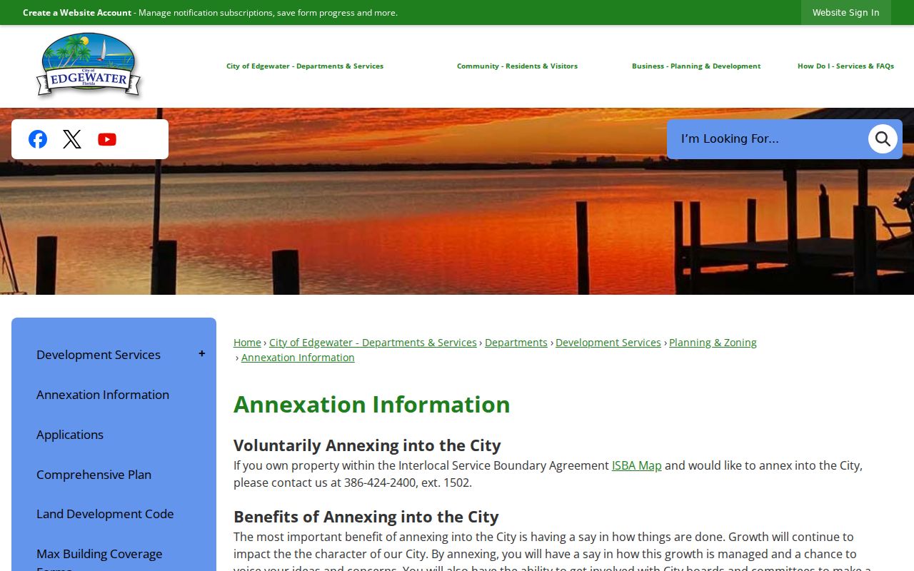
An annexation changes the government boundary without requiring the Postal Service to redraw its delivery code at the same moment.
Volusia County's municipal-boundary data is continually maintained. The layer stores city name, city code, city year, annexation ordinance, adoption date, and acres. Edgewater's city code is 14. Those fields make it possible to ask when a parcel entered the city and to locate the ordinance behind the change, rather than guessing from a ZIP map.
Map Edgewater ZIP Jurisdiction
The Volusia municipal boundary metadata describes the county layer and its annexation fields.
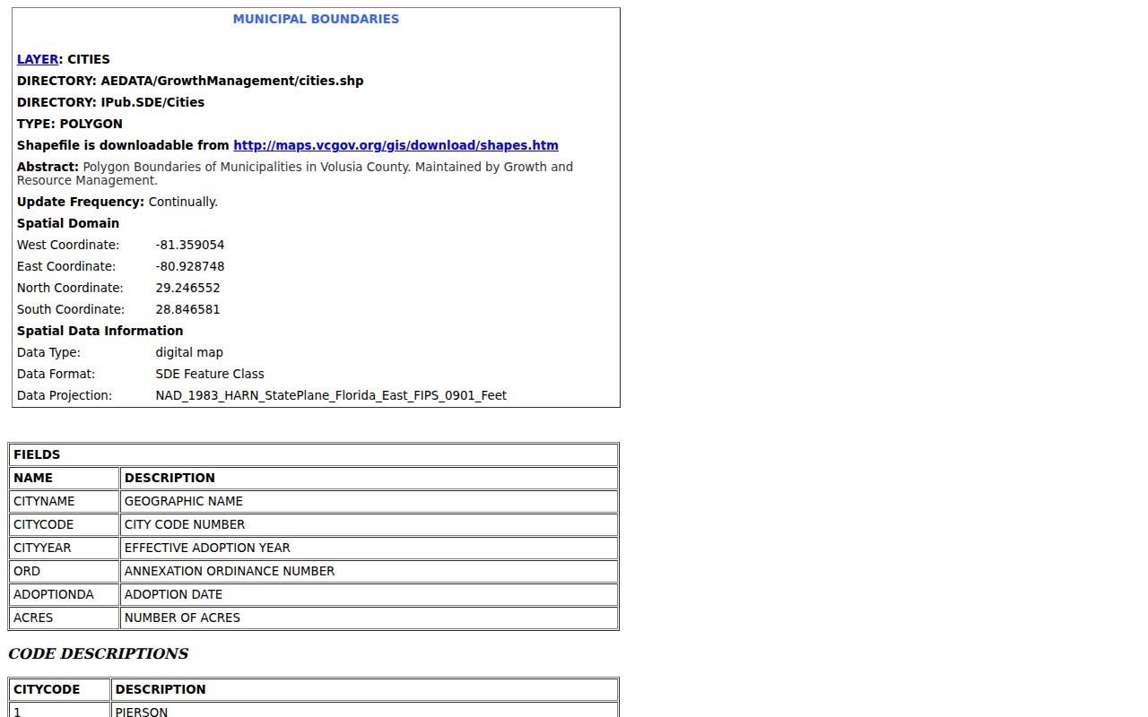
The map supports a parcel-by-parcel city check. It is not an authoritative postal ZIP polygon and should not be presented as one.
When an interactive layer is not enough, request the annexation ordinance or address-assignment record from the responsible city or county office. County GRM Mapping and Addressing can also reconcile parcels, streets, and land-use layers. The official mapbook contact is at 123 W Indiana Avenue, Room 202, DeLand, with phone 386-736-5959.
City One-Stop GIS adds corporate limits, annexations, zoning, code cases, and service-area context. County GRM GIS can search an address, parcel, or street and show land-use layers. Neither map is a land survey. Copy the parcel identifier and ordinance details, record the date viewed, and ask the custodian for the source document when the exact line controls a claim.
Edgewater ZIP Directory Limits
A ZIP code directory can narrow a parcel search and resolve a delivery label. It cannot show who occupies each home, whether a mailing address is current, or how many residents live on a parcel. The appraiser lists owners and land. Voter records cover registered voters subject to exemptions and do not disclose ballot choices. USPS confirms delivery geography, not ownership.
Edgewater reported 24,981 people and 12,289 structures in 2024, but those citywide figures cannot be divided between 32132 and 32141 without an authoritative ZIP-based data table. Likewise, no official citywide ZIP split or realignment year was found. Keep city statistics separate from postal totals and check each disputed address with USPS and parcel geography.
Direct government contact is the final access channel. USPS handles the delivery result. The Property Appraiser maintains the owner, site, mailing, and legal-description fields, while the Tax Collector bills from the certified roll. Edgewater or Volusia staff can route an annexation or address-assignment request. Stating the exact address, parcel key, date range, and desired record will produce a much clearer request than asking for all records in a postal area.
A careful Edgewater ZIP code directory ends with a modest claim: the postal code helps sort records, while the custodian's own field proves the fact each record was built to show.